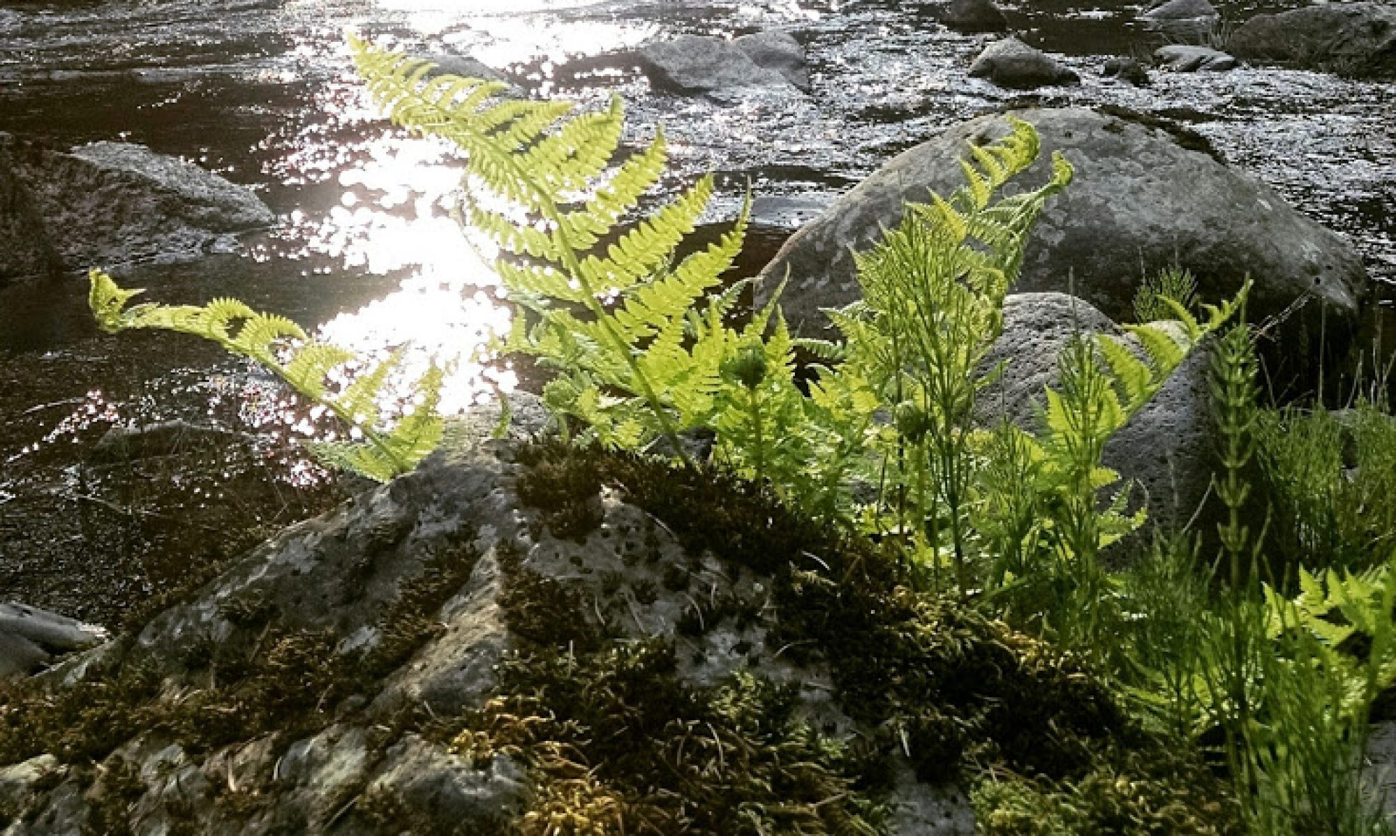

Over spring break, my kids and I decided to try the 4T Trail around Portland. 4T stands for train, trail, tram, and trolley, and it’s a loop that takes you on a trail starting near the Oregon Zoo, up to Council Crest and across to Oregon Health Sciences University, where you catch the Portland Aerial Tram down to the waterfront area. There you can hop on a Portland streetcar (trolley), switch over to the MAX light rail (train), and take it back up to the zoo, or ride it home if you’re somewhere serviced by MAX. (Here is a booklet with detailed instructions and a map.) Although this trail is not in the Chehalem Valley, I’m going to tell this story from the perspective of someone from the Chehalem Valley, because I know there are probably others of you who have thought about doing this trek and wondered what it would take.
My two boys, ages 9 and 5, were able to do this whole trail themselves, although they were pretty tired by the end. (Note: the trail would not work for strollers, so if you have littles, make sure to take them in a backpack! Also note: the tram is not open on Sundays.) We left Newberg a little before noon and got home a little after 6pm. The 4T itself took about 4.5 hours.
Parking: Coming from Newberg, it’s not easy to get there on public transportation, so you probably want to drive at least part of the way, which means you have to decide where to park. You can start the 4T at any point along the loop, and the instructions said we shouldn’t park at the zoo, because that parking area is only for customers of the zoo and the other attractions in that area (the Forestry Center, etc.). Therefore, I decided we should park at the waterfront area. That way, the tram would be the grand finale. My boys were looking forward to that part the most because we often see it flying over the freeway when driving in to Portland, but none of us had ever been on it. Starting at the waterfront was a good idea in theory, but I didn’t think about the fact that the street parking would be 2-hour maximum. Therefore, we had to park in a parking garage. We found one that was $10 for the day, which wasn’t too bad, but would be better to avoid it!
If I did the 4T again, I would drive in to the Beaverton Transit Center and park near there, then take the MAX from there to the zoo. (Parking is free at the Park & Ride for up to 24 hours.) If you did that, both the eastbound red line and blue line trains go to the stop you want, Washington Park. Here’s the full MAX light rail system map. (Note: You could probably park at the zoo, even though the 4T people don’t recommend it. I don’t think anyone checks your tickets for validation as you leave or anything, but the parking lot can get full. It’s $1.60/hour, or $4/day Oct-Mar, or $6.40/day Apr-Sept.)
Since we started at the trolley, I’ll follow our route, but again: you can do the 4T starting at any point.
 Trolley: Alright, so we found a parking spot up by the Riverside area on the streetcar map. A local asked us if we were tourists because I took a while staring at the map, since we weren’t at the stop indicated in the instructions, so I told him I was from Newberg and blamed it on my kids that we were taking the trolley! Being a tourist has its perks, though, because he told us which trolley to get on, and he told us about some construction going on that was causing delays on one of the lines. So if you stare at the trolley map long enough, you, too, are likely to meet friendly Portlanders. If you’re at the base of the tram, SW Gibbs St, you’ll be on the green line on the map, the N/S Line (north/south). That’s the only streetcar that stops there, so you don’t have to actually worry about which one to take. Stay on the trolley until #8 on the map, the Multnomah County Library stop.
 Tickets, Maps, & Fares: You can buy tickets at a kiosk on the trolley, or if you’re starting with the MAX, there are ticket kiosks on the sidewalk at each stop. Here is the Portland Streetcar (trolley) map and the MAX rail system map. You can plan your trip ahead by looking on the TriMet website trip planner page and you can pay your fare from your phone with the Mobile Tickets App if you want, but you can also buy tickets on the trolley or at the train stop. If you’re going to need to take the MAX to get back to your car at the end, you’ll want an all-day pass ($5/adult, $2.50/youth 7-17 or honored citizen 65+, free for kids 6 and under). If you only need it for this section with the trolley and train, you can buy the 2.5-hour pass ($2.50/adult, $12.5/youth 7-17 or honored citizen 65+, free for kids 6 and under). This is your ticket for both the train and the trolley.
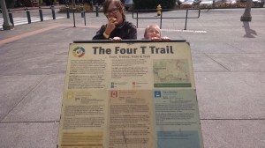
Train: From trolley stop #8, Multnomah County Library, you just have to walk a half-block or so north to get on the train, a.k.a. the MAX, Portland’s light rail system. You’re getting on the westbound red or blue line, which takes you out to the Beaverton Transit Center, but of course don’t take it that far! Get off at the Washington Park stop.
The boys enjoyed riding the train and the trolley! K had never been on one before, and E had only been on the MAX once in memory (as well as New Jersey Transit and the New York Subway when he was too little to remember), so it was a fun event for them.
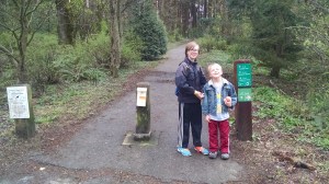
Once we got to the zoo stop (Washington Park), we took the elevator up to the parking area, and lo and behold we saw our first 4T sign! We knew we were on the right track. After a bathroom stop (probably crucial before a 4.5-mile hike and after a couple hours in cars, trolleys, and trains, unless you want to stop in the woods—which might be OK for the kids, but not so socially acceptable for the adults in the group…), we followed the 4T signs around by the zoo entrance and down the hill. The 4T signs led us on a slight detour from the normal route through the parking lot due to a bit of construction, but they were clear and easy to follow. We followed 4T signs across the overpass over Highway 26, and onto the right side of the on-ramp. There’s not much shoulder, but there’s enough space that it didn’t feel dangerous. A little ways down the on-ramp, there’s a trail leading off to the right. It’s clearly marked with another 4T sign.

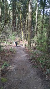
Trail: This section of the 4T follows part of the Marquam Trail for about 4.5 miles if you do the whole thing through the woods. You can make it about 4 miles if you take the “urban shortcut,” which is shorter and results in less uphill hiking (500′ cumulative elevation compared to the full trail’s 800′), but takes you through more residential areas instead of mainly sticking to the woods. As it is, you walk along streets sometimes. There are signs throughout, but I printed off the detailed instructions, just to make sure we didn’t get lost. These helped us feel more secure as we navigated. (You could take the instructions on your phone, but I felt more comfortable with a physical copy in case my phone died.)
The boys wanted to look for other “t-words” along the trail, so we found many: trees, trillium, traffic, trash, “troll bridges,” and so forth. They enjoyed shouting out new t-words as they encountered them.
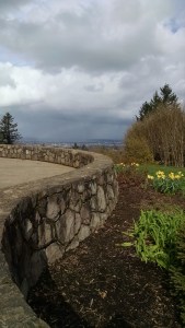
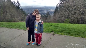
We followed the trail to the top of a hill, walked a few blocks on streets, following instructions and signs, and then got to the Council Crest Trail. That part was probably the steepest, but the boys knew that once they got to the top, it would be the highest point, with a good viewpoint to look out over the city. We ate some snacks under a big tree, then the boys ran around and enjoyed the view. It had been pouring while we drove to Portland, enough so that I asked the boys if they thought we should change our plans, but luckily we never got rained on while we were on the trail! We could see rain in the distance, though, creating a nice rainbow.
After a bit of a rest, we headed down the other side. I asked the boys if they were up for a longer hike through the woods, or if they wanted to do a shorter version on residential streets, and they opted for the woods.
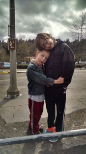
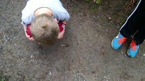
This section was really fun! 4T signs showed us exactly where to go, and other signs told us about the area and how it got preserved as public space. We went through several different preserves and trail sections, all part of the overall Marquam Trail. We saw a slug eating a cherry blossom, and a dead rodent. We heard lots of bird songs. Although we could hear the noise of traffic most of the time, it was not noticeable in most of this section unless one was listening for it. What a gift to have this great network of trails and public wooded spaces available in the middle of Southwest Portland! We had another little snack stop at the Marquam Shelter before heading up the last section of the trail toward OHSU. This part is called the Connor Trail. We got slightly confused right at the end and had to backtrack slightly to find the correct trail exit, but it was clear where we should go once we referred to the paper instructions.
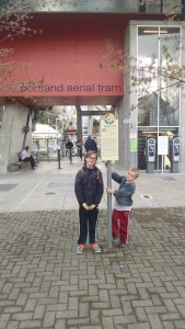
Tram: Once we got up to OHSU, we followed the instructions to the end of the street, turned left, crossed the street under a sky bridge, and continued for a little ways. Here the instructions got confusing, telling us to take a set of stairs up into the Kohler Pavilion, but we found some stairs into a building whose name was not immediately evident. We saw a tram sign, though, so we followed that. It worked out just fine. Whatever building we walked into was connected to the one we wanted, so we walked through, following tram signs until we reached the line for the tram.
We happened to get to the tram right around 5pm, so quite a few people were getting off work and heading down to their cars at the base of the tram. Although there were many people in line when we got there, we only waited for a few minutes for the tram to come, and then all the people piled into the tram. We were able to find spaces next to the wall so the boys could see out, but the tram was VERY full. Another unforeseen problem was that the windows are frosted to what must be about 4′ up, so K wasn’t quite tall enough to see out. Therefore, I had to hold him so he could see the view. This didn’t seem to phase him too much, and the boys enjoyed the ride down, seeing Portland from a different angle.
At this point, we had to walk about a half mile back to our car, so the boys were not particularly happy with that part, but they liked the rest of the experience. Mud from the trail caked their shoes and pant legs and they were tired and hungry, but they were still in relatively good spirits.
Overall, the 4T was a great experience! We all had fun and we didn’t get lost. It wasn’t exactly free, since we had to pay for trolley and train tickets plus parking, but for an excursion around Portland, it wasn’t too bad in terms of expense. Others online mention that they stay on the trolley until it takes them to the park blocks food carts, so if you’re in downtown at a meal time, that would be a fun addition to the experience if you have a little more cash burning a hole in your pocket, and especially if you have visitors with you who want a taste of the Portland foodie scene. This would, of course, add time to the excursion, so if attempting this with small children, one has to weigh whether this extra time is worth the food aspect, or whether it’s better to do the loop more briefly.
 I highly recommend the 4T Trail to anyone who likes both urban and natural settings. It would be great for adults on their own, adults with kids or teens able to walk 4+ miles, or adults with kids in a backpack.
When I asked my boys the next day about their favorite parts, the 9-year-old said the trail, and the 5-year-old said the train, trolley, and tram, so there was something for everyone. Both of them liked getting to go to Portland and spend the day walking around with me. They liked seeing and hearing the wildlife and getting to have new experiences.
Let me know in the comments if you have any questions, advice for other 4T Trail-goers, or stories to share from your own experiences!


Cherice, this is fantastic! I love your ability to do exceptional things like this. I suspect a good deal of the background credit should go to dad Steve and granddad Dick. Thanks for doing so much with your boys.
LikeLiked by 1 person